HIKE: Keālia and Kuaokalā trails, Mokulēʻia, O‘ahu
WHEN: July 2015
LENGTH: 7 miles total roundtrip
DIFFICULTY: Moderate
FEATURES: Hot and dry, exposed ridgeline with stunning views of Mokulēʻia along the Keālia Trail, great for dogs and trail running, hunting and camping allowed on Kuaokalā Trail, native plants and shrubs, spectacular view of Mākua Valley at the end of Kuaokalā Trail
When I first started out with my #40Trails project, I didn’t really have a plan.
There were a few hikes I had wanted to do, but that’s about it. Everything else was up for discussion, and I was very open to suggestions.
So I got a suggestion.
My husband’s friend — both are avid, lifelong hikers — had always wanted to do the 18-mile backpacking hike to Waimanu Valley along the northern coast of the Big Island. You need a permit, gear and stamina to do this hike — and right now, I had none of the above.
So we decided to start really training.
He and his wife were hiking on weekends and climbing the tracks at Koko Crater with packs.
I was still walking up Makapu‘u with my dogs.
But with the camping trip just a few weeks away, I decided I needed to get serious.
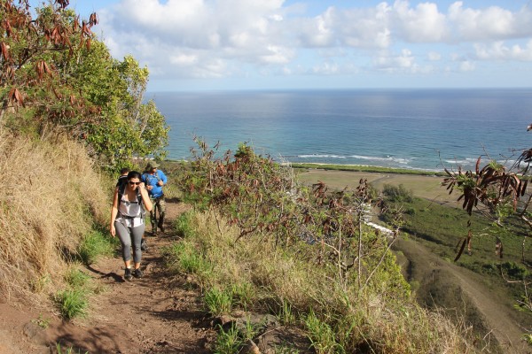
So we decided to venture to O‘ahu’s North Shore and do Keālia and Kuaokalā trails in Mokulēʻia, two connecting trails that offer similar switchbacks and elevation gains as the one to Waimanu.
The three of them — my husband, his friend and his wife — carried packs. I hurt my back surfing and decided to just wear a fanny pack.
So much for training!
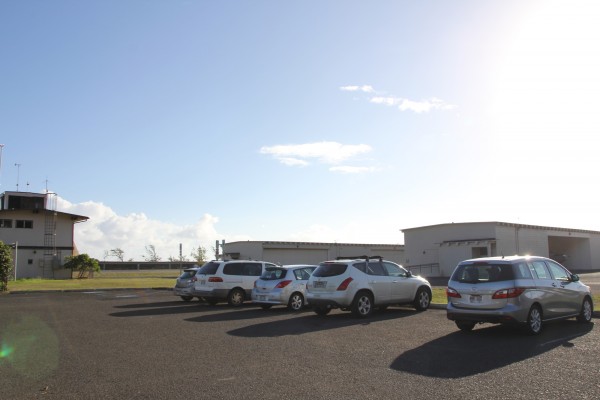
Where we parked our cars.
Walking to the start of the trail.
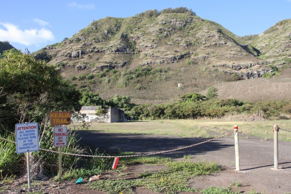
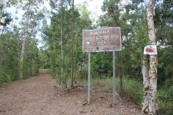
The trailhead is here.
Getting to the start of Keālia Trail needs some explaining.
Basically, head to Dillingham Airfield in Mokulēʻia along Farrington Highway. You’ll see the state’s Na Ala Hele sign for Keālia Trail at the third gate into the airfield. Turn right here. Follow the trail signs to the designated parking lot, located across the street from the trailhead on the opposite side of an open lot. (Just follow the signs.)
In case you’re wondering, Keālia means “salt encrustation.” It was probably given this name because of its location so near the ocean.
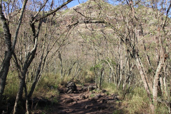
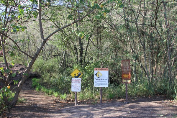
The start of the trail.
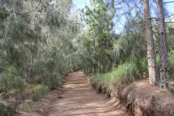
The trail follows the ridgeline of the mountain.
Here’s the trail. The elevation gain is about 1,600 feet.
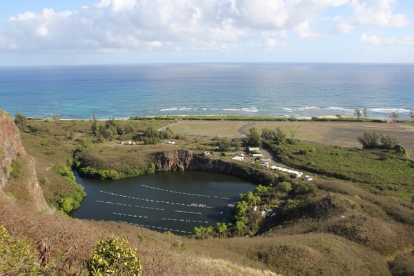
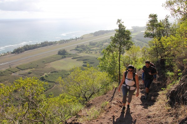
Along the way, you get this stunning view of Mokulēʻia and the coastline. That, to the left, is the old quarry. It’s now an aquaculture farm.
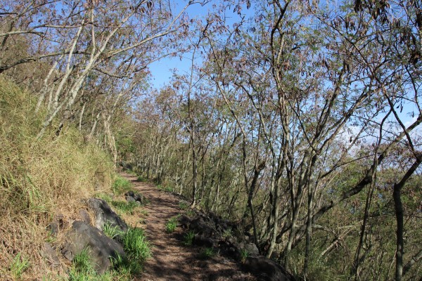
Keālia Trail is known for two things: 19 switchbacks along the pali (cliffs) and sweeping views of Mokulēʻia.
And you get that pretty quickly.
For about a mile, you’re just walking along switchbacks up the mountainside. And the entire time, you get unobstructed views of the coastline, Hale‘iwa, Dillingham Airfield and the fixed-wing gliders that soar overhead.
This part, alone, is worth the drive to Mokulēʻia.
You’ll see a large, water-filled quarry mined by the Army for crushed rock to fill in rice fields for an airfield. Now, it’s used to grow tilapia.
This switchback section was built by the Civilian Conservation Corps in 1934. Along the way you can see native wiliwili trees — its wood was used for surfboards and canoe outriggers — and alahe‘e, another native tree with shiny, oblong leaves.
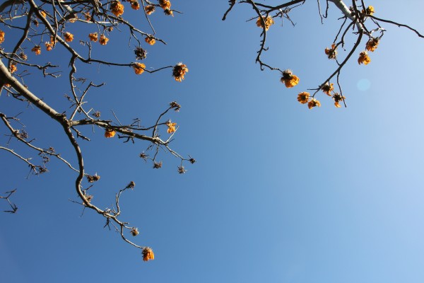
Along the trail, we saw a bunch of flowering wiliwili trees. These are endemic to Hawai‘i.
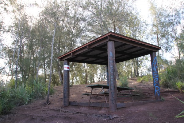
The end of Keālia Trail.
It took us just 45 minutes to get to the end of the Keālia Trail, which is marked by picnic table under a shelter (above).
We had started the trail fairly early, around 7:45 a.m., so by the time we reached here, there was no one else. (We found out on the way down, though, that this is a more popular trail than we had anticipated. There were about two dozen hikers lounging here, enjoying the view and having lunch.)
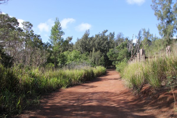
The second part of the trail is this access road.
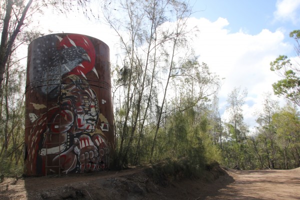
A water tower on the trail.
The second part of this trail follows a series of access roads that take you to a lookout at Mākua Valley on O‘ahu’s West Side. The paths here are wide and well worn, big enough for trucks to get through. We encountered a couple of backpackers who had camped at nearby Peacock Flats. They told us about some hunters with dogs on the Kuaokalā Trail. It was a welcomed warning.
Walking along the Kuaokalā Trail, lined with ironwood and eucalyptus trees, toward Mākua Valley.
Obviously, hunters have been here.
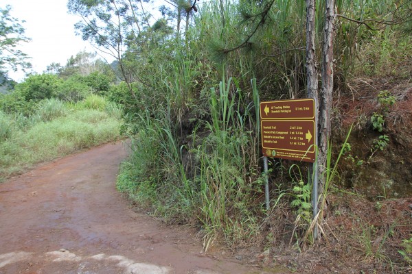
Follow the signs. These trails are well marked.
The up-and-down characteristic of this trail was great training for my hiking buddies, who opted to lug their camping packs. But don’t let the wide trail fool you: this is a long, tiring hike that really works your legs and backsides.
But stay the course. The view at the end is worth the pain.
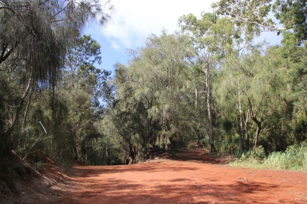
This well-worn trail is more often used by trucks and cars than hikers.
Almost at the end!
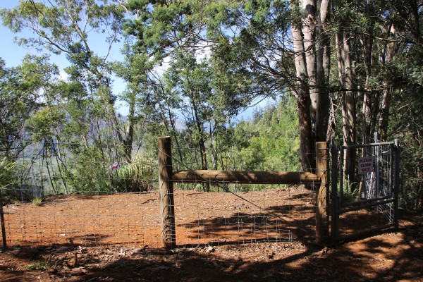
Go left at the intersection, down a gulch and up along a ridge. In fact, go left whenever you can. This will lead you to a fence line — no doubt to keep pigs out — with a gate. Go through the gate and you’ll see the trail goes left and right.
Right takes you to another lookout with amazing views of the remote Mākua Valley.
But if you just go straight ahead, you’ll find a small opening that was good enough for us!
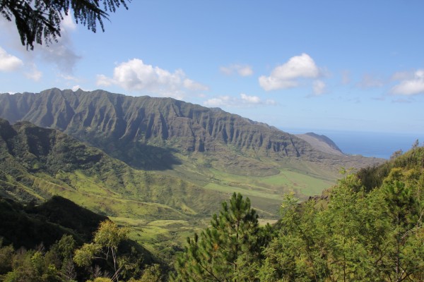
There is it — Mākua Valley
A word about Mākua: For years — though not anymore — the U.S. Army used this culturally and geologically significant valley on O‘ahu’s western coastline for live-fire operations. It’s home to scores of ancient Hawaiian artifacts, cultural sites and about 50 endangered plants and animals.
You don’t often get to view this sacred valley from this vantage point, and it was really humbling to stand there and witness its majesty.
It took us about an hour to get here from the end of Keālia Trail, so 1 hour and 45 minutes total.
And now we had to head back.
Good thing we brought snacks.
VERDICT: Both Keālia and Kuaokalā trails have their own charms. Keālia offers sweeping views of O‘ahu’s North Shore from the start and Kuaokalā ends with an unforgettable glimpse of Mākua Valley. Both trails aren’t terribly difficult, but they do offer a great workout — and, it seems, great training for longer hikes. It’s just a long haul from Honolulu, though it gives you an excuse to get margaritas in Hale‘iwa!
***
Follow my hiking adventures #40trails at Instagram (@catherinetoth), Twitter (@thedailydish) and Facebook (/thecatdish).


5 Comments
CAT: I guess you guys will be training next for the “Amazing Race”.
Your article mentions Dillingham field. But did you know that there’s no Dillingham airfield anymore? Hawaiian sovereignty activists don’t like the Dillingham family and were successful in pushing a bill through the legislature to change its name to a Hawaiian name in Act 276 of 2001, found in Haw. Rev. Stat. § 261-27. This is a small part of an ongoing ethnic cleansing of Hawaii history and the names of places and streets.
I remember this was an awesome hike with fantastic views. We currently live on the mainland (and can’t wait to be able to move back to the islands!), so it was nice to see the pictures of this hike and the description there of. Looks like you guys had lots of fun! Keep up the good work, and the hiking! 🙂
Thank you for the hike tips! We did the Kealia trail yesterday – I don’t think I’ve been out that way since I was a kid. Mahalo!
Great write up and photos, we would love your review (and photos) of this trail here too: https://lookintohawaii.com/hawaii/48961/kuaokala-trail-activities-oahu-waialua-hi …mahalo!