HIKE: Pu‘u Mā‘eli‘eli, ʻĀhuimanu, O‘ahu
WHEN: June 2015
LENGTH: About 1.5 miles roundtrip (50 minutes total)
DIFFICULTY: Easy
FEATURES: Short hike with big payoff, views of Kāneʻohe Bay, well-worn trail, great for kids, dog-friendly
You won’t find much written up about this hike.
Even in Stuart M. Ball’s “The Hikers Guide to Oʻahu,” the Pu‘u Mā‘eli‘eli in Temple Valley is listed as a closed hike. The description is short and sweet — and accurate: “The climb to its top is short, but steep.”
Finding the trailhead is the hardest part of this hike.
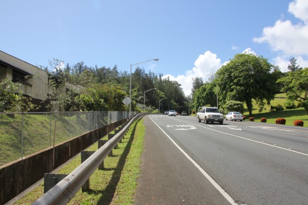
The start of the trail is located just off Kahekili Highway across the street from the Valley of the Temples in ʻĀhuimanu. When you approach Ko‘olau Center (formerly Temple Valley Shopping Center), you’ll see McDonald’s; take that right on East Hui Iwa Street. Park anywhere in this residential neighborhood.
Once you’re parked, you need to walk back to Kahekili Highway and hang a left. Carefully — carefully — walk along the highway, staying close to the guard rails. In a few minutes, you’ll see a yellow marker and, usually, an orange cone. This is the start of the trail.
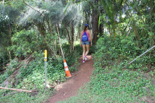
The orange cone marks the start of the trail.
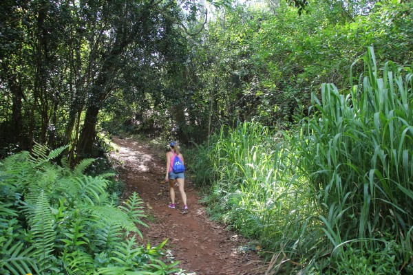
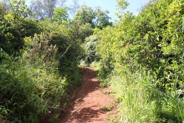
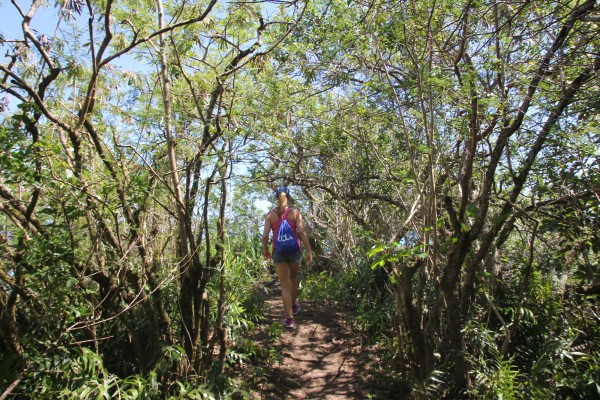
The trail is well worn and easy to find.
This trail traverses through private property, which is why it’s listed as “closed” in the guidebook. So respect it — like you should any trail, really. But it wouldn’t take much for the landowner to shut down access to this hike. We’ve seen that happen so many times because hikers don’t heed warnings, go off-trail, get hurt, destroy property, abuse the privilege — yes, privilege — to hike in these areas. So be respectful.
Clearly, this is a popular trail. You can tell by the well-worn path hikers and mountain bikers have made.
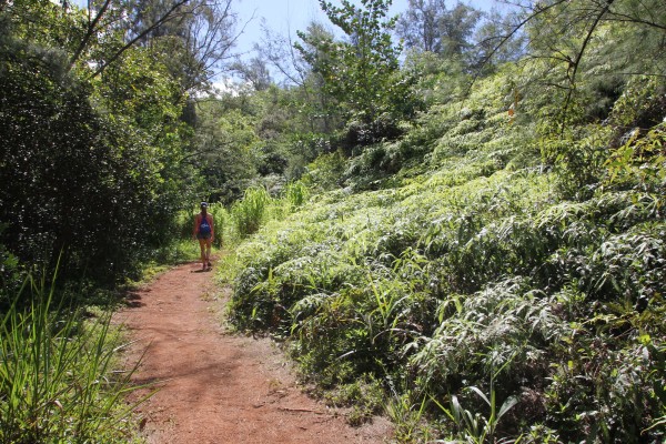
The red-dirt trail winds up the hillside toward an overlook, less than 2 miles one way.
There’s not much in the way of native plants here. You’ll see bamboo orchids, strawberry guava and the occasional noni tree.
This was a Saturday morning — and we didn’t run into anyone on the trail.
The first time I did this trail was a year ago. On a whim. It was 10:30 a.m. on a Sunday and I was desperate to get outdoors. My husband, an avid hiker, can be a bit of a snob when it comes to trails. He likes the unbeaten paths, the remote hikes, the ones the require backpacks filled with Band-Aids, LED headlamps and at least two liters of water.
But somehow I convinced him to go on this short hike on the windward side — and, even more surprising, he actually enjoyed it.
So I went again recently with my girlfriend on a sunny Saturday morning. She hadn’t been done this hike, either, and was pleasantly surprised, too.
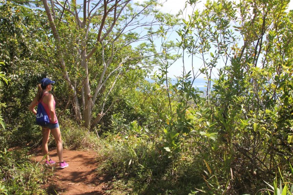
About halfway to the summit, you’ll catch glimpses of Kāneʻohe Bay.
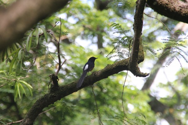
It’s not a native bird, but I always enjoy seeing these white-rumped shamas!
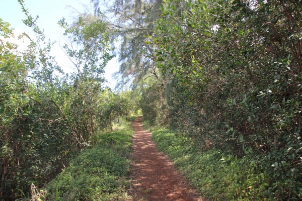
The trail is mostly uphill, with very little in the way of treachery. So it’s not uncommon to see kids and even dogs making the trek to the World War II bunkers at the top.
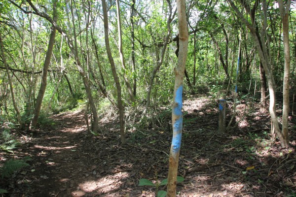
We saw this blue paint everywhere on the trail. We figured this was a way to mark the trail? We’re not sure.
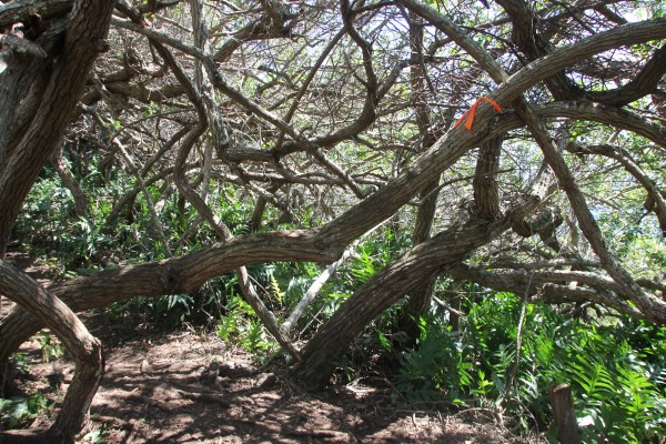
And then there were the orange/red ties on trees. Don’t worry. The trail isn’t hard to keep to.
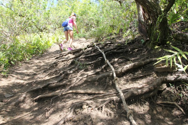
This was the hardest part of the trail — with the rope. Although, neither of us used it. I’m sure it’s helpful when this trail is muddy.
There’s a wooden sign (below) toward the end of the trail near the first bunker that explains a little about this hike.
Here’s what it says:
According to Hawaiian mythology, Pu’u Ma’eli’eli translates to “Digging Hill.” The companion-Gods, Kane and Kanaloa, once raced to the top of the hill and had to dig into the slope with their hands to climb up. The bunkers found on the summt are the reminants of the Heeia combat training area (Camp Heeia) built during World War II to support nearly 4,500 military personnel.
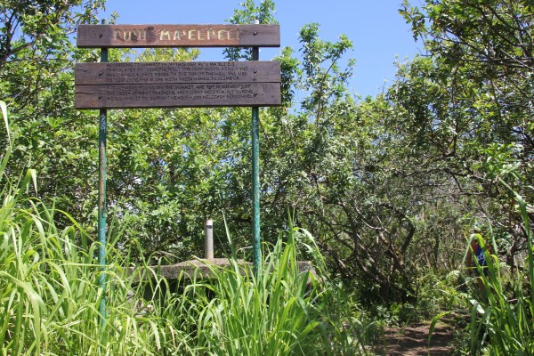
Here’s the sign.
It’s a little walk from the sign until the last bunker — with the million-dollar view.
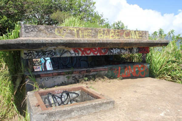
Here’s the bunker.
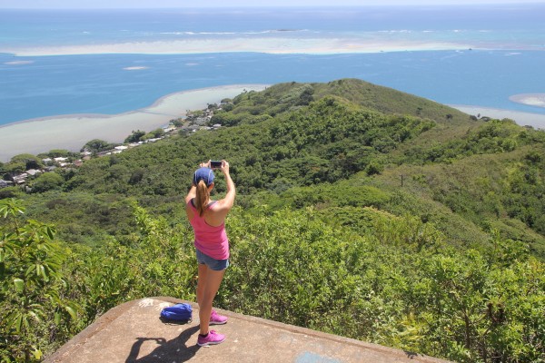
Finally, after about 30 minutes of walking, you’ll come to the last bunker. And the view is one of the best I’ve seen on any O‘ahu hike, to be honest.
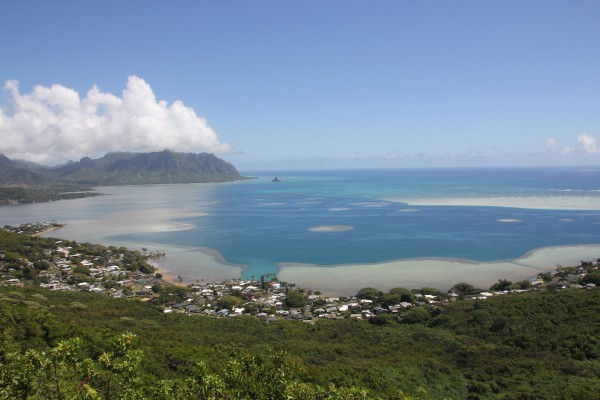
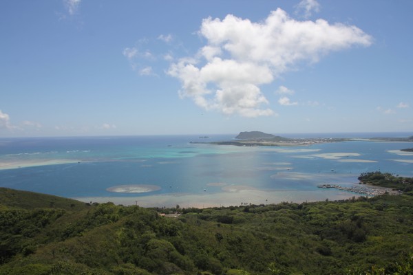
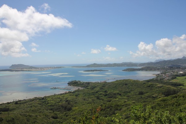
It’s a panoramic view of the windward side — from Kualoa (and Mokoli‘i Island) and Kahana Valley to the left and the Marine Corps Base of Hawai‘i to the left. And in front of you, all of Kāneʻohe Bay spreads out. It’s quite breathtaking.
You can see there’s another trail leading from the bunker down to He‘eia — and yes, you can actually hike from here to He‘eia State Park.
Ah, maybe next time.
VERDICT: This easy hike is great for kids, families and dog owners. (We did see two dogs on this trail that day.) It took us less than an hour to complete the whole hike — with enough time to grab lunch at nearby Windward Mall. It’s a great, short hike for busy folks who want to get in a quick workout — with a view — and get on with their weekends.
***
Follow my hiking adventures #40trails at Instagram (@catherinetoth), Twitter (@thedailydish) and Facebook (/thecatdish).


6 Comments
The bunkers indicate the level of human activity in the immediate area and along the trail 70 years ago. It’s a good reminder of how qickly and and completely the rest of nature reclaims a piece of land and erases signs of our presence, when we humans tread lightly or not at all for a while.
Yep, definitely true. Did you see what’s tagged on the bunker? Made me laugh.
There’s another trail very near the one you hiked. It’s called Ulupaina. Entrance is through the pet cemetery along Kahekili Highway in Temple Valley, and it follows the ridge that borders the cemetery, all the way to a hill that’s too steep to climb. Look up info on Google. There are wild pigs that create wallows at a couple of places, and a bee hive or three.
OoOOoo, thanks for the tip!
OK now that I’ve done this one, I have to say that when it’s raining, it’s not something you can classify as easy. It was actually a little dangerous coming back down in the mud! Dry days? no problem…..
Great write up, we’d love your review (and photos) of the trail here: https://lookintohawaii.com/hawaii/44561/puu-maelieli-trail-digging-hill-hike-activities-oahu-kaneohe-hi