HIKE: Waipo‘o Falls Trail, Kōkeʻe, Kaua‘i
WHEN: March 2015
LENGTH: 2 miles, roundtrip
DIFFICULTY: Moderate
FEATURES: Birding, native plants, waterfalls, canyon views
KŌKEʻE, Kauaʻi — After driving for about an hour from Līhuʻe Airport to Kōkeʻe State Park — OK, we stopped for taro chips and a slice of lilikoi chiffon pie in Hanapepe — we arrived at the state cabin we had rented smack in the middle of the afternoon.
It wasn’t enough time to hit one of the longer trails that ambles along the ridge lines with specatular views of the stunning Nāpali Coast. But, according to the map we had picked up in the museum, we just had enough daylight to get to Waipo‘o Falls and back. (The “and back” part was the most important.)
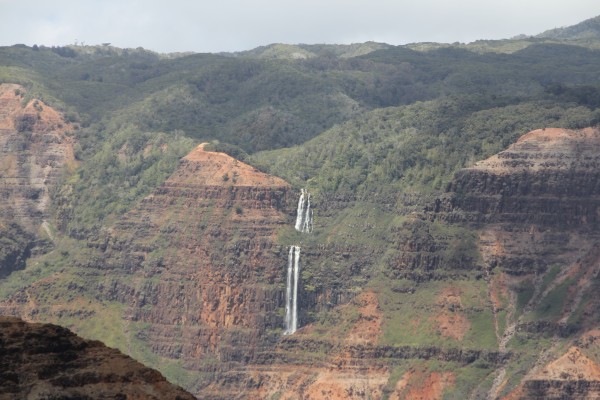
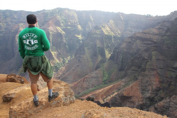
We had seen the 800-foot falls (top) from the Waimea Canyon Lookout on our way to the state park, located on the island’s west end. I didn’t realize we could actually traverse the trail above it — and all within about two hours! Sounded like a plan!
Spread over 4,345 acres on a plateau as high as 4,200 feet above sea level, Kōkeʻe State Park is loaded with hiking trails — 45 miles, to be exact — through all sorts of terrain, from lush native forests to rugged ridges. Some of these trails lead to view of Waimea Canyon, others open to the fabled Nāpali Coast.
We were heading into the canyon.
Waimea Canyon, itself, is a destination on Kaua‘i. Called “The Grand Canyon of the Pacific,” it’s quite a sight to behold. It stretches an impressive 14 miles long, one mile wide and more than 3,600 feet deep. Its crested buttes, rugged crags and deep valley gorges are absolutely stunning.
The Waipo‘o Falls Trail would give us a different view of the canyon — from the opposite side of the lookout.
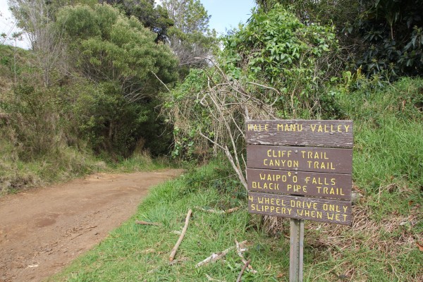
The hardest part was actually finding the trailhead.
From the Waimea Canyon Lookout, you have to drive north along Kōkeʻe Road (550) for about four miles until you get to a dirt road — called Halemanu Road — on your right that descends into Waimea Canyon. On the opposite side of the road is a dirt parking area. Park here and walk across the street to the trailhead. There’s a sign (above), but you might miss it.
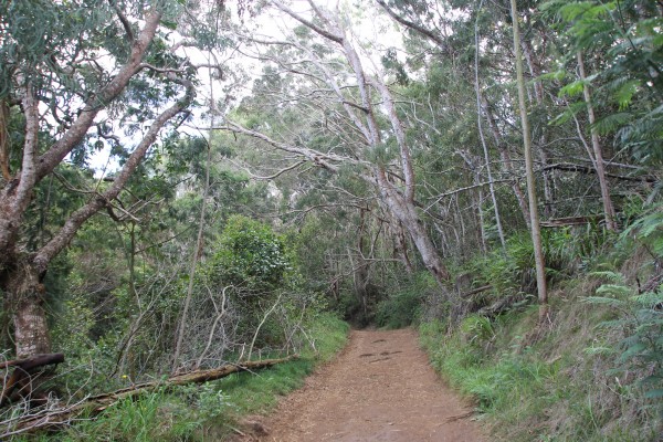
From the road, the trail widens into a well-worn path through both native trees (like koa) and invasive plants (like nasturtium). Less than a mile in, you’ll hit the junction for the Canyon Trail. Take that. Then shortly after, you’ll approach another split — one leads to Waipo‘o Falls, the other to a cliff viewpoint. Take the first one.
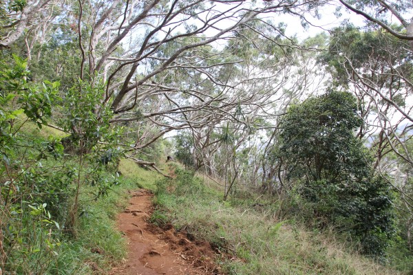
Even though this trail is listed as about two miles long, I was surprised by the up-and-down terrain. (I bet when it’s raining, it’s not fun.) While it’s not difficult — it really isn’t — it was more tiring than we had anticipated, especially after a long day of driving and eating taro chips. But the trail views — a native forest filled with the chirps and songs of endemic Hawaiian honeycreepers — really made this an enjoyable trek.
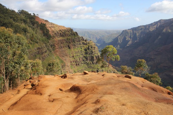
As you approach the 1-mile turnaround, the trail opens up to this: a sweeping view of the canyon in all of its glory.
You won’t see the waterfall from this trail, and I almost didn’t care, what with these canyon views. I loved the contrast of the amber dirt and the olive vegetation against the bluest of skies. We must’ve spent more time here than anywhere else on this trail — including the swimming hole at the end.
From this point, it was a short walk — maybe less than .2 mile — to the falls. Meaning, the first tier of the falls.
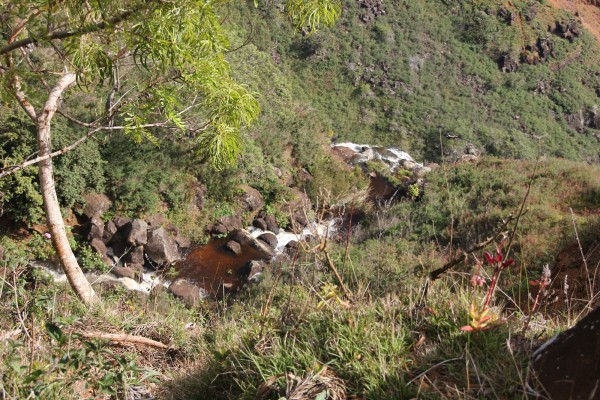
The trail is above the top of the waterfall, which cascades down 800 feet to the canyon floor below. It’s a long way down — and the photo above doesn’t do it justice. This is just the first — and smaller — of the falls that hits the rock ledge before spilling over and into the canyon.
I snapped that photo by hovering over the edge of the cliff a little ways off the trail. This was the best I could do to get a glimpse of the falls from above without risking my life — and it was the safest viewing spot we could find. I wouldn’t venture any further off the trail here, though.
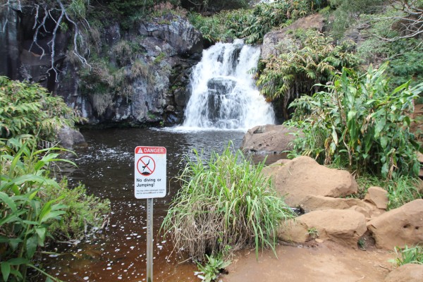
The trail ends here, at the top of the waterfall. This ‘awapuhi ginger-lined steam and swimming pool is your final stop. Even though I grew up in Hawai‘i — and wading in swimming holes was a childhood pastime — I decided to skip the dip and just appreciate the view.
We headed back the same way we came, remembering the hilly terrain and how challenging that can be for tired legs. We wound up making great time on the way back, reaching the junction in about 20 minutes. (Yes, 20 minutes. It took us an hour to get to the falls!)
VERDICT: Great hike for anyone, just make sure you have enough time (meaning, daylight hours) to complete it based on your skill level, speed and Instagram needs. It’s a short trail with a big payoff, with unforgettable views of the canyon. And you might catch a a peek at a native bird, too.
***
Follow my hiking adventures #40trails at Instagram (@catherinetoth), Twitter (@thedailydish) and Facebook (/thecatdish).


4 Comments
Cat: Good thing you decided against the dip…Leptospirosis is real possibility.
No kidding! But I think Hawai‘i peeps are immune to that. LOL
Hello Cat,
I did that hike many many years ago. Two down and 38 to go!
ACK. 38. My feet already hurt!