HIKE: Wiliwiliniu Ridge Trail, Wai‘alae Iki, O‘ahu
WHEN: May 2015
LENGTH: 5 miles roundtrip
DIFFICULTY: Moderate
FEATURES: Native plants and birds, views of Waimānalo, camping allowed, stairs and section with ropes
I couldn’t remember the last time I had hiked to the summit of the Wiliwilinui Ridge Trail in East Honolulu — but I did remember two things: the stairs and the ropes.
This trail, located at the top of the exclusive Wai‘alae Iki subdivision, is very similar to its neighboring trails, Hawai‘i Loa and Kuli‘ou‘ou, in terrain and views. And they all have those freaking stairs.
But I digress.
Since the trailhead is located in a gated community, you have to declare your intentions to a friendly guard on Laukahi Street. He will hand you a parking pass with instructions on how to get to the start of the trail. There’s a small parking area — you can’t park anywhere else — that limits the number of hikers and hunters that are on the trail. Which is a great thing, actually.
(And please abide by the rules and regulations. The Wiliwilinui Community Association has been really cooperative in allowing the public to access this trail. So let’s not screw that up.)
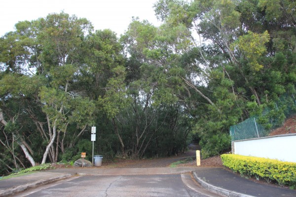
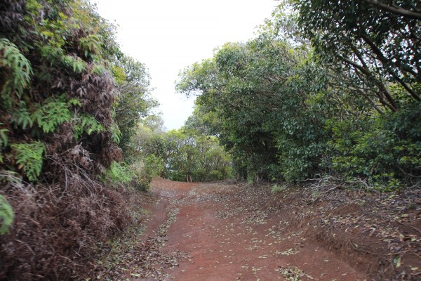
Here’s the start of the trail.
The first part of the trail is paved.
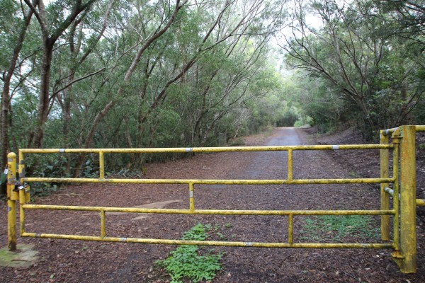
The trail starts on a dirt access road through formosa koa and waiawī (guava) trees up Wiliwilinui Ridge. This was built by the U.S. Army back in 1941, so the road is wide and well graded — and, subsequently, popular with mountain bikers and trail runners.
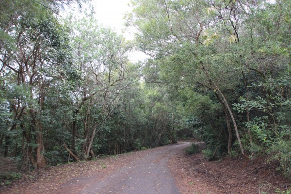
Of the three trails along this stretch of the Ko‘olau Mountains, this hike is probably the easiest. Kuli‘ou‘ou is windy and long, with lots of switchbacks; the last section of the Hawai‘i Loa Ridge Trail is a stiff climb to the top. But on this trail, you get to leisurely walk along a paved road for more than a mile before climbing a ridge to a HECO tower.
Albeit, it is uphill.
We spent this part of the hike chatting incessantly about everything from Sunday dinner plans to the woes of trying to get pregnant. (It’s not as easy as it looks.)
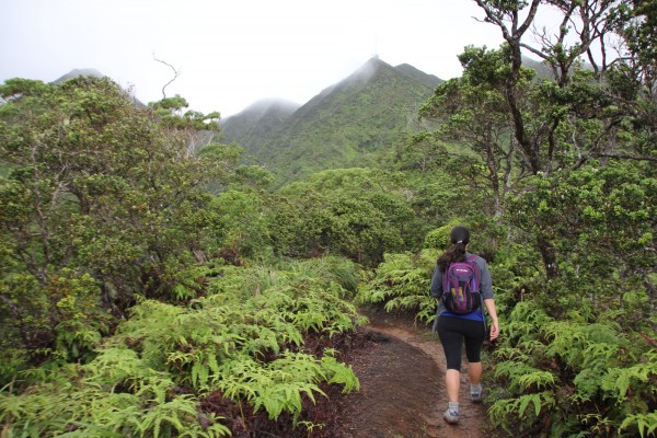
Despite the relative ease — and concrete — the trail, itself, is still a walk through a forest of native koa and ʻōhiʻa trees, ironwoods, some Cook pines. You may even glimpse the endangered — but curious and friendly — O‘ahu ‘elepaio (monarch flycatcher) here.
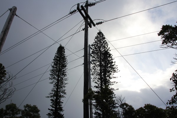
The sight of power lines does diminish the whole “nature” feel of this hike a bit, but it’s still a beautiful trail.
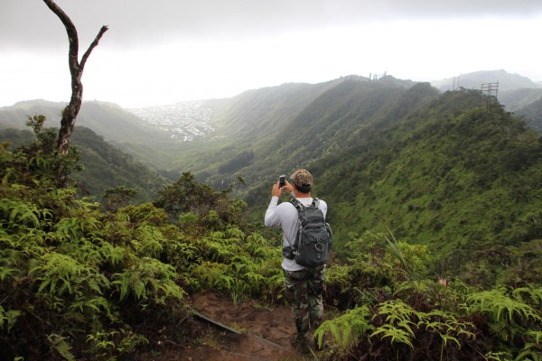
We stopped to take in the view of ‘Āina Haina to the east. This residential community was named after local dairyman and owner of the Hind-Clarke Dairy, Robert Hind. Hence, the name, which means, “Hind’s Land.”
After about 40 minutes from the start, you’ll reach an open clearing with a large tree and a swing (below). I’ve sat in the swing. It’s stable. And it’s a great excuse to take a short break before heading up the steepest part of the trail to the summit.
The stairs were placed years ago to stabilize the hillside and make access to the summit easier. I wouldn’t want to hike to the top without them, that’s for sure.
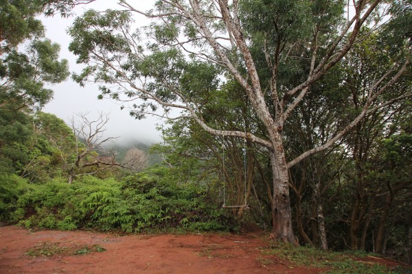
The swing marks the start of the hardest section of the trail.
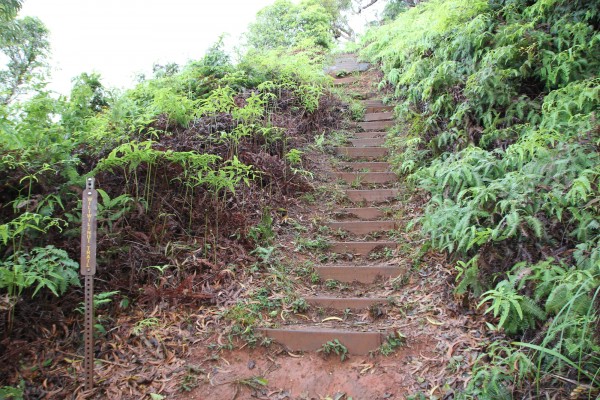
The stairs to the summit.
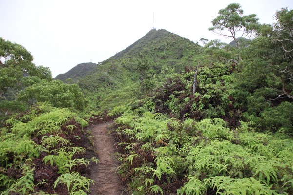
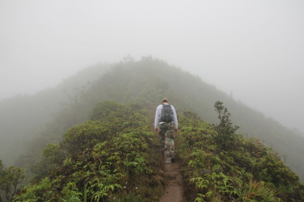
After a few sections of stairs, you’ll reach a flat section with a clear view of the summit in sight (below).
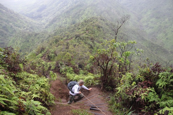
We didn’t pick the most ideal day to do this trail. It had been raining for days leading up to the hike, making the trail muddier and slipperier than we would have liked. And we could already tell the clouds had rolled in, blocking the view from the summit.
The upside, though? We only encountered three other people — and a dog named Missy — on the trail.
Here’s where the trail starts to get a bit more difficult.
There’s a steep section, deeply rutted from rain and erosion, with ropes at the final push to the top. It’s not overly hard; you just have to be comfortable climbing with ropes and not worried about getting muddy. (Then again, I’m a big fan of ropes and mud.)
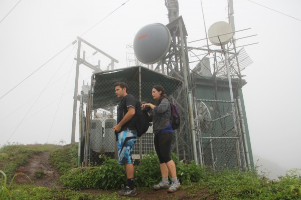
After this section, you’ll approach a communications tower (above) — another strange sight on a ridge hike — and a sign that you’re almost to the top.
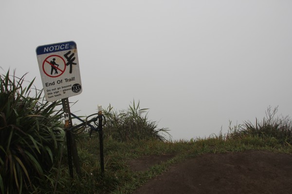
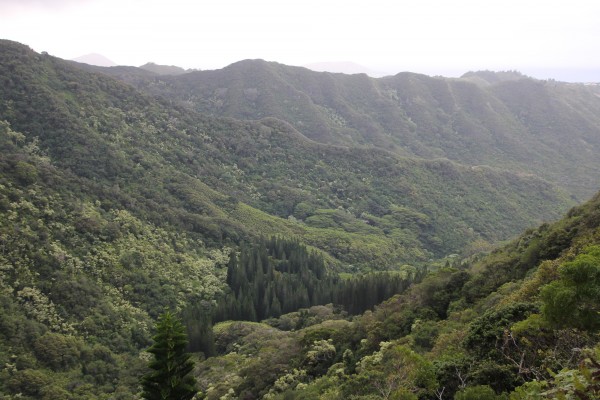
The summit isn’t incredibly spacious, and there’s a small bench at the top. The views at the top — on a clear day, of course — are incredible. You’re at about 2,500 feet elevation, overlooking the windward coast from Kualoa Point to Waimānalo. You can see the three peaks of Olomana and the summit ridge to Kōnāhuanui, the highest peak in the Koʻolau Range. (That’s another hike, for sure.)
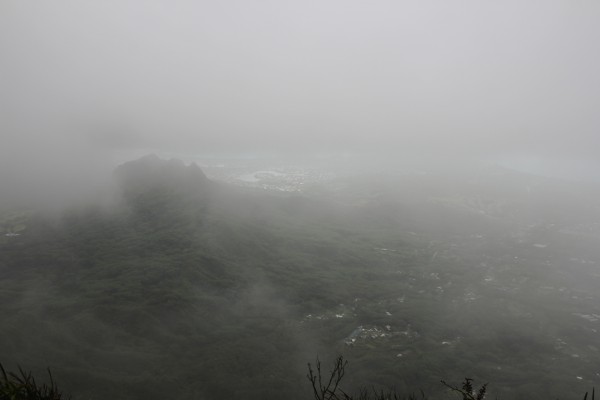
But alas, we were socked in — until just when we were going to head down. The winds suddenly changed and we were able to get a very, very quick view of the coastline and Pacific Ocean.
Kismet.
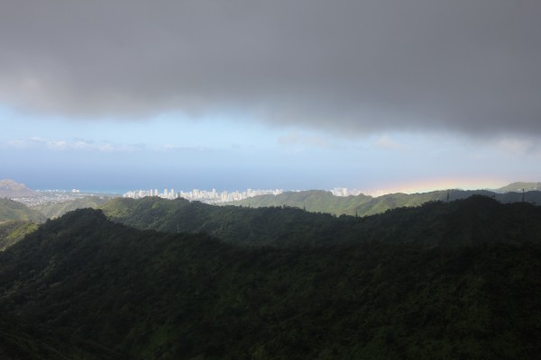
Then on the way down, we caught this view (above) of Downtown Honolulu and Waikīkī — complete with a rainbow.
It took us less than three hours total to complete the trail, though we weren’t trying to break any records. It was just a nice morning to catch up with great friends – and get in a workout, too.
It never hurts to have lunch plans right after, either.
VERDICT: This is the easiest of the three trails — Hawai‘i Loa and Kuli‘ou‘ou — to the Ko‘olau summit on this side of the island, with the first quarter of it paved. If you can ignore the power lines and asphalt and focus on the native trees and ferns instead, this is a very enjoyable hike that ends in spectacular views of the windward side of O‘ahu. And it won’t take up your entire day, either.
***
Follow my hiking adventures #40trails at Instagram (@catherinetoth), Twitter (@thedailydish) and Facebook (/thecatdish).


4 Comments
“We spent this part of the hike chatting incessantly about everything from Sunday dinner plans to the woes of trying to get pregnant. (It’s not as easy as it looks.)”
???
Trying to get pregnant? I guess I should blog about that one day!
CAT: People with pets may have a harder time getting pregnant…I think it may be a psychological thing. Pets are your surrogate children.
Yes, I’m a mother to three dogs and five chickens. And a foster parent to a baby goat. That’s not too shabby!