HIKE: Kalāwahine Trail, Tantalus, O‘ahu
WHEN: May 2015
LENGTH: 2.5 miles roundtrip
DIFFICULTY: Easy
FEATURES: Native trees and plants, birds, valleys and gulches, tree snails, feral pigs.
We really weren’t planning to hike that day.
It just sort of happened.
That’s why we’re so fortunate to live on O‘ahu, where a hiking trail is literally a short drive away from anywhere on the island. In this case, it took us maybe 15 minutes to get to the trailhead of Kalāwahine Trail on Tantalus.
It’s a trail I’ve often done, the last time years ago with a group of coworkers, one of whom carried a six-pack of beer in his backpack the whole way. Along with ice.
As you can tell, it’s not a difficult trail.
The hardest part is really just finding parking.
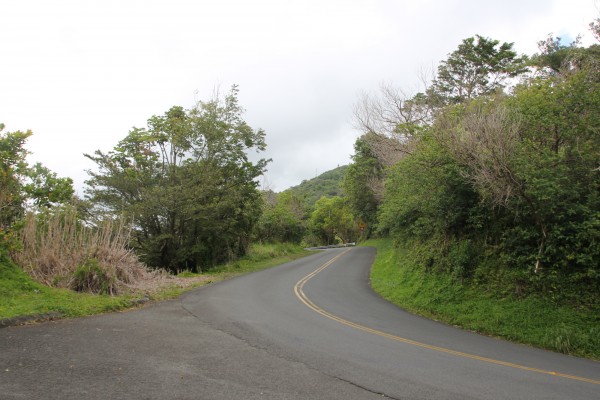
Tantalus Drive, where the trailhead is located
The trailhead is off Tantalus Drive (see above). There’s very limited parking near the start of the trail, located just beyond a narrow bridge and adjacent to a private road that goes uphill. You can also park in an area just before the bridge in a sort of pull-off on the turn. (That’s where we ended up parking.)
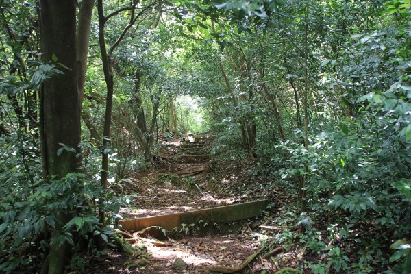
The start of the trail.
A bandana tied to the post means there’s a hunter around. And we met up with him early into the trail — with six dogs. We were glad we didn’t bring the #ratterpack!
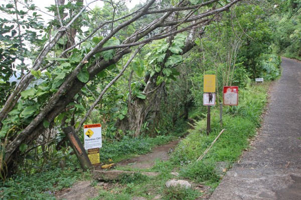
The trailhead (above) is right at the junction between Tantalus Drive and a private road (called Telephone Road on Google Maps). It’s well marked and there’s brush at the start where you can — and should — remove dirt and seeds from the soles of your shoes.
Kalāwahine Trail is part of a larger system of interconnected trails over Makiki known as the Honolulu Mauka Trail System. It starts near the top of Tantalus, a cinder cone called Pu‘u ʻŌhiʻa on the southern Ko‘olau Range. The trail contours along the edge of Pauoa Valley and to a lookout with views of Nu‘uanu Valley.
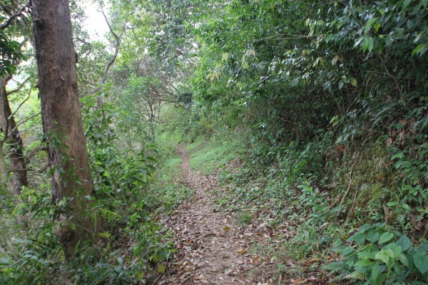
The start of the trail. Its name, Kalāwahine, means “the day of women.”
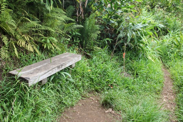
A rest stop with a recently planted koa tree.
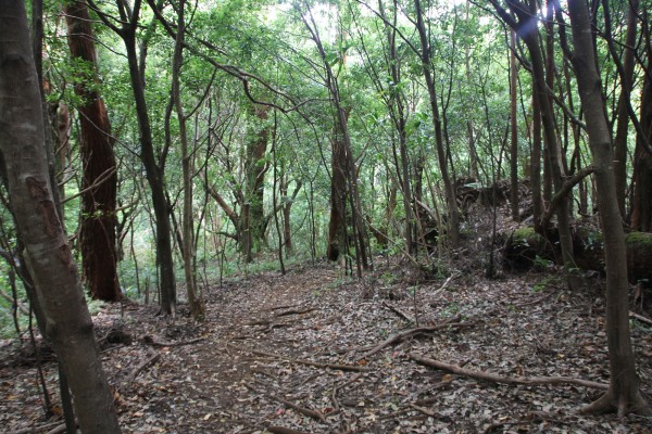
Another scene from the early parts of the trail.
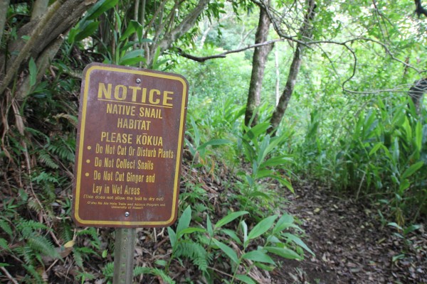
Snails ahead!
Near the start, there’s a small gully that’s marked as tree snail habitats (above). There’s a patch of kalo (taro) and white ginger here. And the snails were pretty easy to spot.
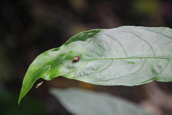
Here’s one. There were many more on nearby plants.
Most of these tiny snails were brown in color, like the one above, and cruising on the ginger leaves.
Just a century ago, snails — like the kahuli — were plentiful here. In fact, students from Punahou School would collect the shells of these land snails and even hunt for duck in this area back in the 1840s. One account says there were more than 2,000 kahuli snails — now all extinct — collected on a single hike. I can’t imagine.
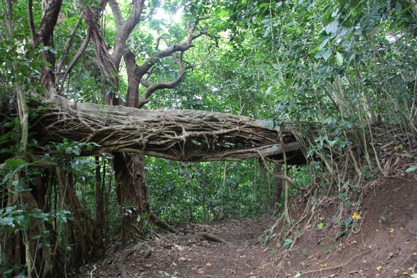
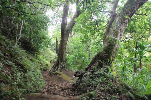
My favorite twisted tree on this hike.
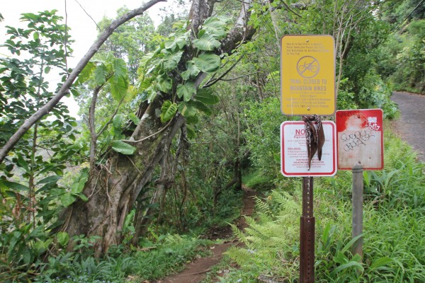
Watch for signs like these.
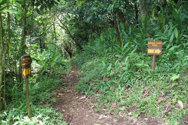
Kalāwahine Trail is part of a large, meandering network of trails; in fact the Makiki-Tantalus Trail, alone, uses 18 different trails in the Honolulu mauka system. So there are lots of junctions everywhere, including on this seemingly easy-to-follow trail.
It’s actually not.
My husband, who’s an avid hiker, has admitted to taking wrong turns on this trail system. You really need to keep a lookout for signs — and they’re not always so obvious.
This trail intersects with the Mānoa Cliff and the Pauoa Flats trails. Take the wrong turn and you might end up at a waterfall in another valley.
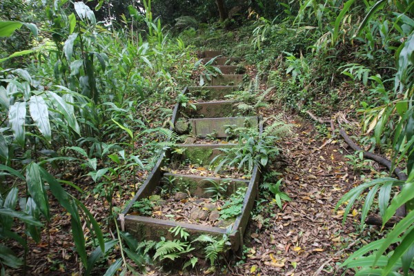
While this trail is mostly flat, there are spots with stairs. But seriously, this is as hard as it gets.
You’ll hit this open area — which my husband says is perfect for paint balling. (Yes, he grew up in the ’90s.)
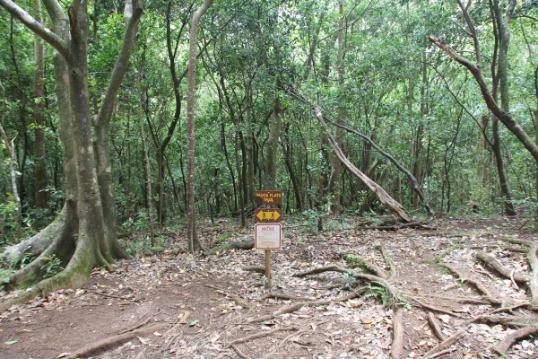
Here’s another junction, though, according to the sign, you can go either way.
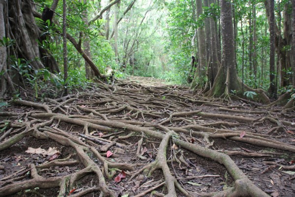
Just a glamour shot of the forest.
At that Pauoa Flats Trail junction, you can either go right or left. If you go right, you’ll end up at a midpoint on Mānoa Cliff Trail. Left takes you to the Nu‘uanu overlook — where we had wanted to end up.
For those of you who are into birds, you won’t find native ones here. But you’ll find the white-rumped shama — originally from Malaysia — with its variety of songs. It often mimics other birds, too. So whistle. You might get a whistle back.
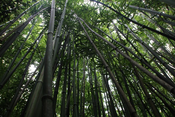
When you go left, you’ll walk through a thick bamboo grove.
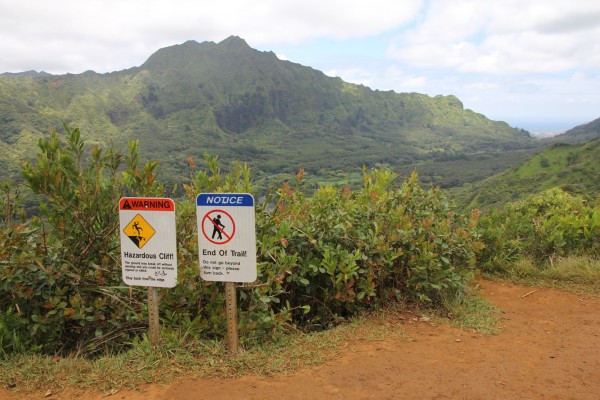
The end!
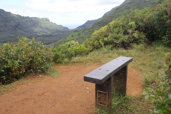
There’s a nice little area where you can sit and gaze out into Nu‘uanu Valley — or drink some champagne, which is what we did.
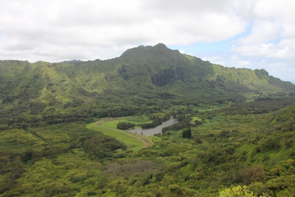
The view of Nu‘uanu Reservoir.
It doesn’t take too long from the bamboo forest to hit the end of the trail — there are signs saying it’s the end — at this overlook. You get a stunning view of Nu‘uanu Valley and the reservoir.
This reservoir — technically, Nu‘uanu Reservoir No. 4 — was a favorite spot for my family to fish. Once a year, the state would open it up to anglers looking to catch the catfish and tilapia that are stocked there. But budget cuts forced the shutdown of the hatchery operations here in December 2009.
Some people actually ignore “No Tresspassing” signs and climb the 50-foot tower and jump into the reservoir. People have died doing this. It’s stupid. I don’t recommend it.
But I do recommend this hike. It’s so much nicer to see the reservoir than be actually in it.
VERDICT: This is an easy trail, something you could squeeze in after work or on a lazy Sunday morning. It’s a nice walk through trees and along gullies, very peaceful and quiet despite being just minutes from a bustling city. And maybe you can glimpse a tree snail, too.
***
Follow my hiking adventures #40trails at Instagram (@catherinetoth), Twitter (@thedailydish) and Facebook (/thecatdish).


2 Comments
Excellent job on this one, would you mind uploading some of your photos and give your review/opinion of this trail for us: https://lookintohawaii.com/hawaii/35580/kalawahine-trail-activities-oahu-honolulu-hi
Great description! Thanks for clarifying this hike for me. Cute blog too! Mahalo.