HIKE: Friendship Garden, Kāneʻohe, O‘ahu
WHEN: June 2015
LENGTH: 0.6 mile
DIFFICULTY: Easy
FEATURES: Short hike with great views of Kāneʻohe Bay, historic, great for kids, pet-friendly
Dog owners are always on the lookout for pet-friendly hikes.
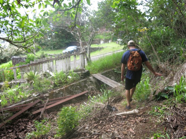
So when I heard about a little-used trail in Kāneʻohe that allows leashed dogs, I quickly put it on my #40Trails list.
But the Friendship Garden wasn’t exactly what I had expected.
For starters, it has a very interesting history.
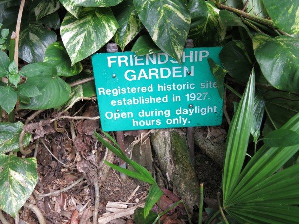
The sign at the start of the trail.
Turns out, this 10-acre on the slopes above Kāneʻohe Bay — above the Kokokahi YWCA — is a garden created for the residents of this small, 87-lot subdivision developed in 1927 as Hawai‘i’s first interracial community. This garden was built as a place of peace and tranquility, to be enjoyed by everyone.
There’s a teahouse, a banyan valley, bamboo grove and less than a mile of non-stenuous hiking trails that offer stunning views of Windward O‘ahu.
It’s hard to believe there was a need to create a multiracial community in such a multiracial place. But back in 1927, Rev. Theodore Richards, who was then the principal at Kamehameha Schools, and his wife, Mary Atherton, purchased 41 acres here and built Kokokahi (which means “of one blood” in Hawaiian). At the time most people lived in camps or areas segregated by race. But not here.
The garden fell into disrepair, especially after World War II. In 1973 Jack Gillmar and his wife, Janet, took out a 50-year lease for the garden, at $1 a year, promising to restore it. In 1998 a nonprofit was set up and the garden was deeded to it.
Today, volunteers maintain the trail and the nonprofit, Friendship Garden Foundation, collects donations for its upkeep.
The trailhead starts in this community, at the top bend of Kokokahi Place just off Kāneʻohe Bay Drive, mauka of Kokokahi YWCA.
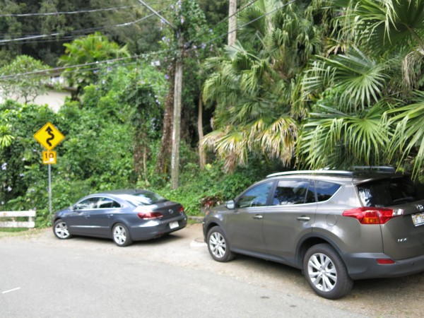
There’s hardly any parking here — see above — so you’ll need to find a spot in this residential area and walk.
Once you get here, though, the trail is well marked, with signage and even a pavilion where you can learn more about the gardens and pick up a map of the trails.
If you see this, you’re at the right spot!
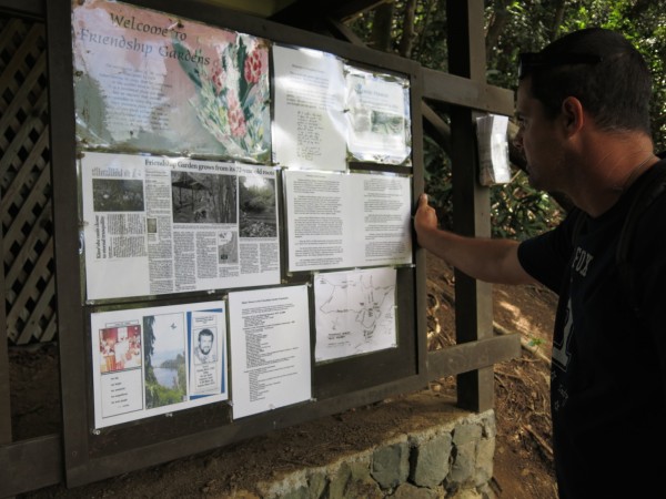
Inside the pavilion is a bulletin board with stories and information about the gardens. It’s worth stopping here to read about it.
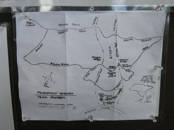
Here’s the map of the trails. There are several ways to navigate this area.
As you can see from the above map, there’s an upper and lower loop. The view that everyone raves about is located at the upper left-hand corner of the map, labeled as “ridge lookout.” Just keep heading to the left and you’ll see it.
It’s easy to get there, too. It took us maybe 15 minutes total to reach the top.
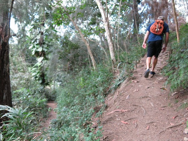
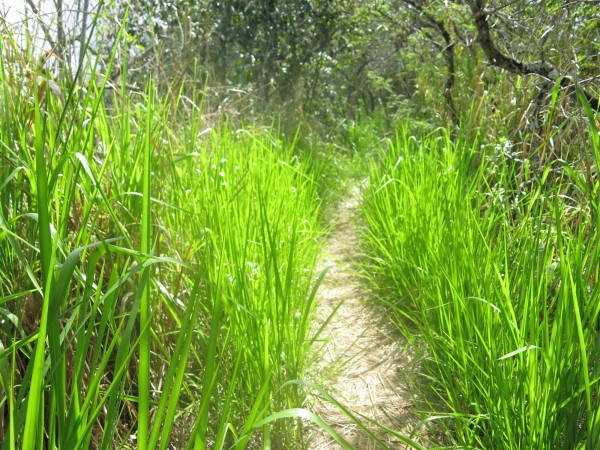
The trail meanders along several switchbacks to the ridge lookout.
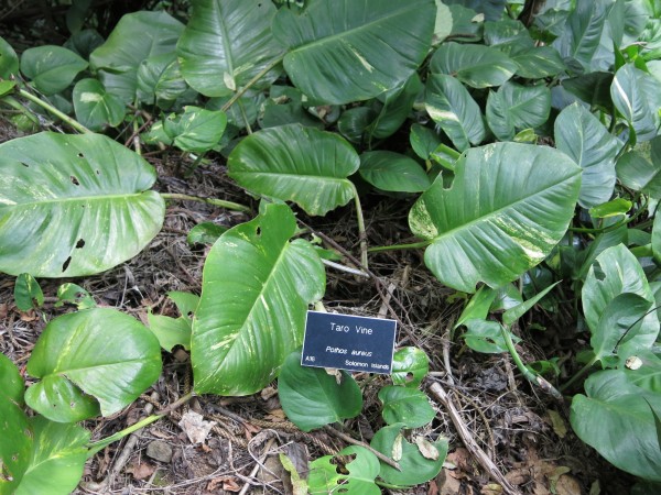
Taro vine — one of many various plants and trees in this thought-out but non-manicured garden.
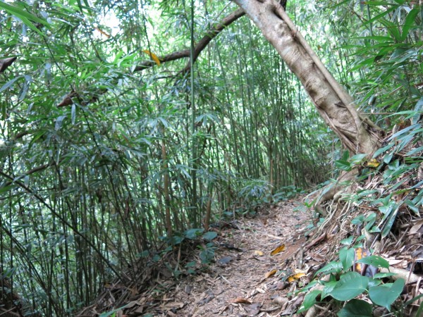
The bamboo grove heading toward the ridge lookout.
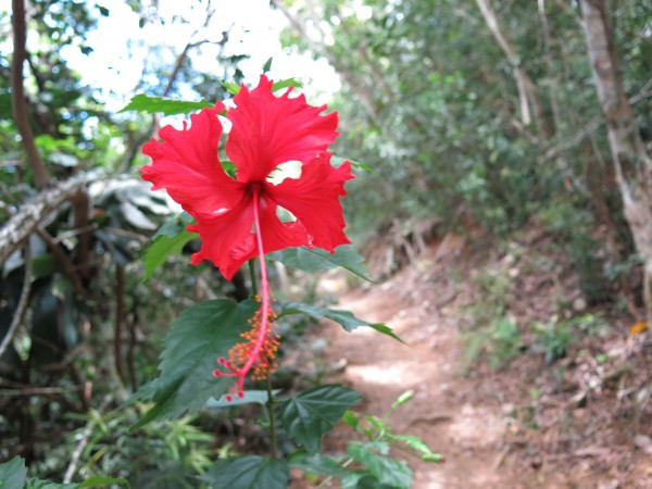
I loved seeing red hibiscus on the trail. Nice pop of color!
The trail takes you through groves of macadamia, banyan, mahogany, strawberry guava and eucalyptus trees, many of them marked with plaques.
And soon enough — like, in 15 minutes — you’re approaching the top.
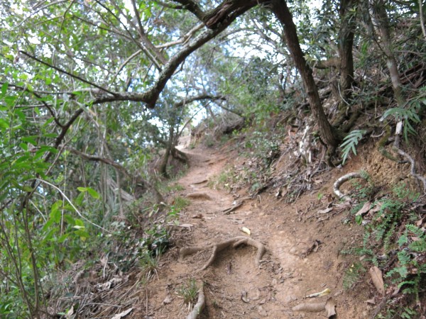
Part of the well-worn trail to the lookout.
The last push to the clearing.
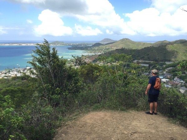
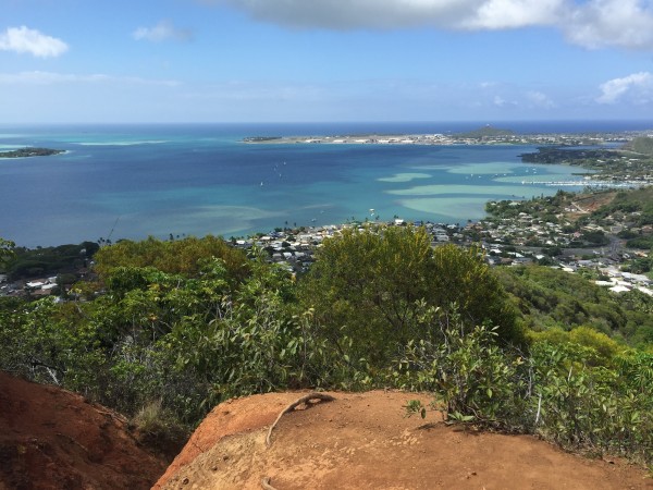
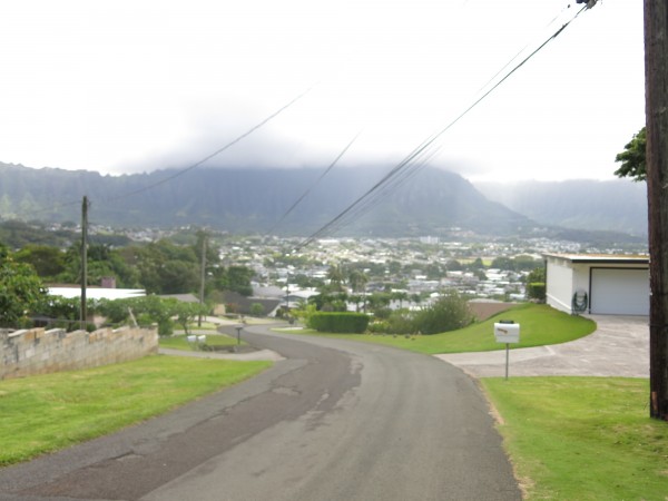
The ridge lookout is pretty nice, though the views of Kāneʻohe Bay aren’t as spectacular as the ones from the pillboxes at the end of Puʻu Māʻeliʻeli in Temple Valley. But the trail is easier and shorter and you’ll likely run into way fewer people along the way.
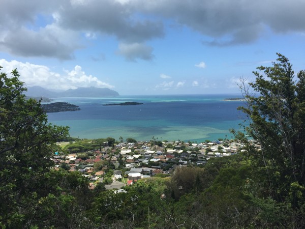
Here’s the view.
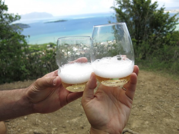
Of course, we brought champagne! This bottle came from one of our winery visits in the Russian River Valley, Calif.
OK, so here’s where the trail got interesting.
If you look on the hand-drawn map, you’ll see the ridge lookout in the upper left-hand corner, then the Talbott Trail starts here, through a grove of Norfolk pines.
We had initially walked along that trail before heading to the lookout when a couple with a dog stopped us and said that wasn’t a trail. In fact, the woman told us it was dangerous.
But I looked at the map again. Wasn’t that the Talbott Trail? Isn’t it just another half-mile loop back to the start?
Apparently, no.
We started up that trail, thinking it was going to lead back to the trailhead — and our car — and it didn’t.
But it turns out, this is a whole ‘nother trail, called Oneawa Hills, which heads along the ridge and away from Kokokahi.
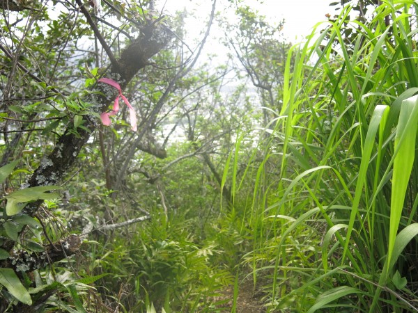
But it was a marked trail and well-worn, so we didn’t hesitate.
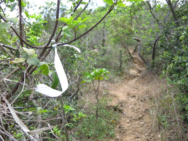
See? It’s marked!
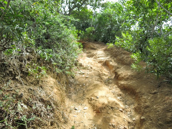
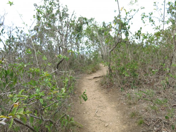
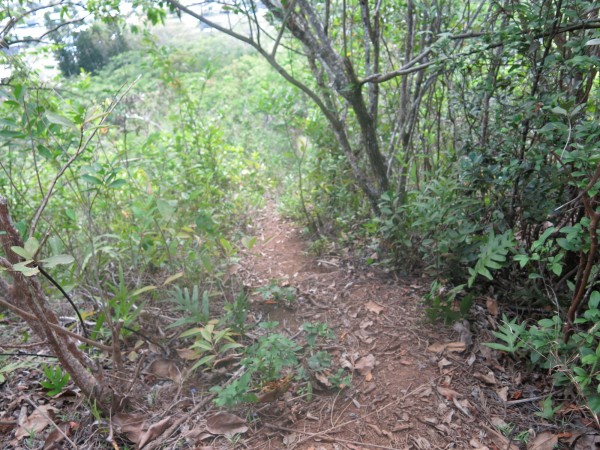
This is a more challenging hike, with steep sections that required some tree-gripping along the way.
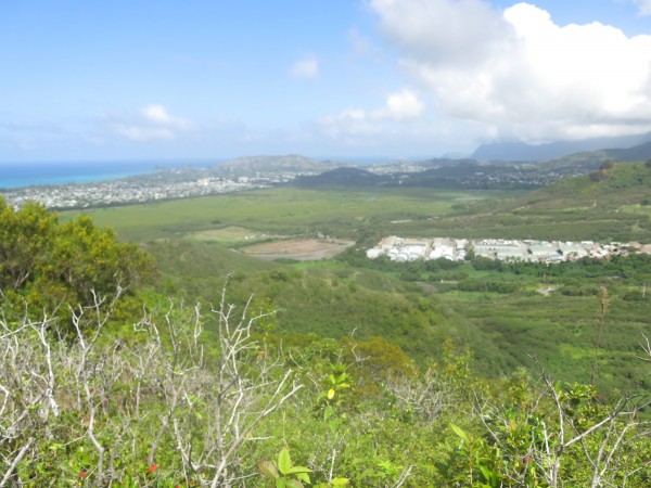
But stops along the way offered even better views of Windward O‘ahu — we were even higher above the tree line — and the 800-acre Kawai Niu Marsh (above), the largest wetlands in Hawai‘i.
Here’s a better view of Kāneʻohe Bay.
The Oneawa Hills trail is not as well-used as the ones throughout the Friendship Garden, but it’s obvious people still hike through here fairly regularly.
We kept trudging along, passing telephone poles and reaching what appeared to be a communications tower of some sorts surrounded by a fence.
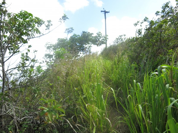
Here’s one of the telephone poles we followed along the trail.
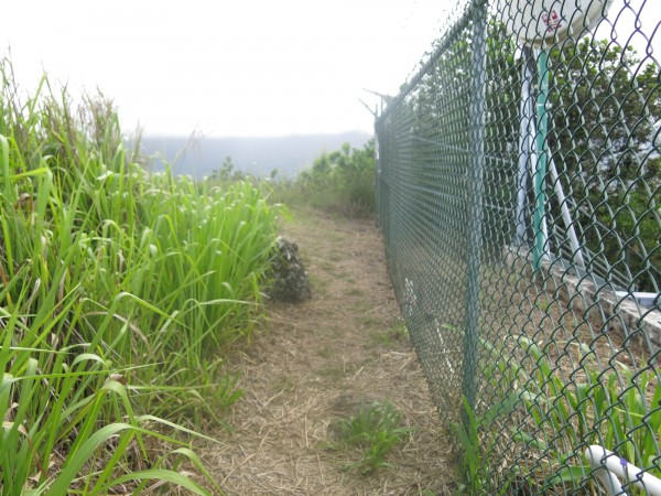
We walked along the fence to find the rest of the trail. It’s there, on the other side of the fence.
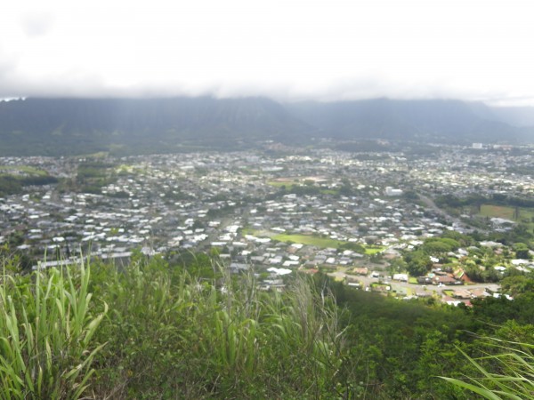
There’s another clearing here, which offers sweeping views of the opposite side of Kāneʻohe.
We made our way down a very steep, slippery trail — still marked! — past the fence, down toward another residential community. Not the only where I had parking my car.
The marked trail leading down the ridge.
It’s not a hard trail, but it is steep on the descent. I slide a few times, so be careful and wear shoes with good traction.
I’m not sure if we actually did the official Oneawa Hills trail, since we didn’t hit a rope section or any great views of Kapa‘a Quarry and the green-colored pool that lies below it. But we did follow the ribbons and wound up in someone’s backyard. (We tend to do that often.)
The end of the trail — is here.
We ended up in a residential community about a mile away from our car.
We popped out on Nāmoku Street, close to Bay View Golf Course, and had to walk all the way back to my car, parking the slope of Kokokahi Place.
It was a brutal walk, so long, in fact, I almost considered catching the bus back.
It’s funny — I had commented to my husband at the ridge lookout that I didn’t even need to wear shoes on this hike, it was so easy and quick. And here we were, two hours later, walking along Kāneʻohe Bay Drive with no water on one of the hottest days in June.
At least we could laugh about it — and got a decent workout, too.
VERDICT: The Friendship Garden is a great trail for families and dog owners who are looking for an easy, safe and short hike with a nice view. I’d recommend touring the gardens more — there’s a Japanese teahouse that we never saw before we took the wrong trail — and quiet spots to sit and relax. If you’re planning to do the Oneawa Trail, might be good to pack some water.
***
Follow my hiking adventures #40trails at Instagram (@catherinetoth), Twitter (@thedailydish) and Facebook (/thecatdish).


6 Comments
CAT: You may not have had water, but had champagne!
This is VERY true! #alwaysprepared
That was my playground growing up in that neighborhood.
I really wish I stayed on the trail — at least to see the rest of the loop! But that’s OK, we had our own little adventure!
Here’s more information about the history of Kokokahi Garden and neighborhood.
Eloise Aguiar wrote about it in the Advertiser on April 25, 2002 at
https://the.honoluluadvertiser.com/article/2002/Apr/25/ln/ln10a.html
Theodore Richards developed the neighborhood specifically for the purpose of creating a multiracial group of neighbors. He sold house lots by racial quota to ensure a good mixture. He called it Kokokahi (one blood) in honor of the first sentence of the first Constitution of the Kingdom of Hawaii proclaimed in 1840, which was written jointly by American missionary William Richards (after whom Richards St. next to Iolani Palace is named) and King Kauikeaouli Kamehameha III. In that Constitution the King voluntarily gave up his absolute power and officially recognized that chiefs, commoners, and people of all races share fundamental rights. Here was a King whose right to dictatorial authority was earned by the conquests of his father, but whose heart was infused by his love of God and by compassion for his people, enlightened by awareness of democratic principles brought to him by newcomers. That first sentence, the “Kokokahi Sentence, says “Ua hana mai ke Akua i na lahuikanaka a pau i ke koko hookahi, e noho like lakou ma ka honua nei me ke kuikahi, a me ka pomaikai.” In English, it can be translated into modern usage as follows: “God hath made of one blood all races of people to dwell on this Earth in unity and blessedness.” And so that’s the inspiration for the creation of the Kokokahi neighborhood of Kane’ohe. For more information see “The Aloha Spirit — what it is, who possess it, and why it is important” at
https://tinyurl.com/66w4m2
You mentioned that at the end you popped out on Namoku St. Right off of Namoku St. is Lipalu Place, a very short dead-end residential street. At the end of Lipalu you can park and walk into a small forrest with some nice rocks. There’s a trail toward the back, on your left, that’s a little hard to find. It goes up a steep hill for a fairly short distance, and at the end is Kawa’ewa’e Heiau, which I helped clean and restore in a gang organized on Saturday mornings by Charlie Ogata, about 10-15 years ago. He had a model of the heiau, about the size of a microwave oven, which he carried in the trunk of his car to give an explanation to the gang before work began.
This is a luakini heiau (human sacrifice) with a big story. Olopana, high chief of Kane’ohe, kept chickens. The demigod Kamapua’a (shape-shifter half human, half pig) liked to steal Olopana’s chickens to eat (sorry Cat! I remember your pet chicken.) So Olopana repeatedly sent bigger and bigger groups of soldiers to capture Kamapua’a and took him to the heiau to kill and sacrifice him; but Kamapua’a kept killing all the soldiers and escaping. Finally, facing the biggest group of soldiers ever, Kamapua’a killed them all, ran away, got his family and ran with them all the way to Kaliuwa’a (the box canyon now known as Sacred Falls). He shifted shape into a huge pig and grabbed the cliff wall just below the waterfall so his family could grab the hairs on his back to pull themselves to the cliff above and escape; and then Kamapua’a pulled himself up to the top of the cliff and escaped. That’s why you can still see grooves in the cliff wall below the waterfall — scrape marks made by Kamapua’a’s claws.
When you’re done with the heiau, you can go to the same corner of the heiau where you entered but go back down by following a different path that winds through a dense woods and ends up in a grove now sometimes used for paintball recreation, and then go out basically right where you went into the little grove at the end of Lipalu Place.